Enjoy nature and unique limestone hill formations on this 10 km hiking route starting in Beuron. The Upper Danube Nature Park area in southern Germany is an often-overlooked area. It’s so close situated between the much more famous Black Forest and Lake Constance, it’s a shame the Upper Danube Nature Park isn’t more popular. We took this as a reason enough to spend a half-day hiking trip there. On the drive to Beuron, we already noticed we were passing by various cities, which feel like they are always getting smaller and more remote. Ideal for a hiking adventure in nature. As we decided on this short ten-kilometer walk, instead of the online often suggested 15+ km routes, we only spent the afternoon/early evening in Beuron. A glorious decision, as we have only passed less than 10 other souls on this walk. Starting hikes against the typical daytime can sometimes be super rewarding!
Read in other articles more on how to get to Beuron and where to park in Beuron to go hiking, as well as other suggestions for hiking routes in Beuron and the upper Danube nature park area.
Hiking trail Route Directions: 10 km circular Route in Beuron
This hiking trail circular route is adapted from the “Rundweg Beuron 3” published by the city. Their route is apparently 6,7 km long, this one, according to Google, is 10 km. Feel free to use my route created on Google Maps, or rely on the signs on-site in Beuron for an offline hiking adventure. For this short “7 to 10 km” route, look out for the 3 signs on the blue waypoint signs. They will direct you in a circular route. If you use Google Maps for navigation, you can even download maps for offline navigation, did you know? Ideal for hikes, nearby where you live, or in other countries.

Circular route Beuron 3
Directions: Monastery car park – Historic covered wooden bridge – Maria Trost – Rauher Stein Hiking Centre – Alpine Garden – Eichfelsen lookout point – Alpine Garden – Vögelesruh – Jägerpfad – Felsentunnel – Sonnenhaus – Hermannsteg – Monastery car park
Route: 6.7 km Walking time: 2 1/2 hrs.
Markings: Please follow the markings of the newly designed hiking trail signs, Route 3 for this route.
if the map below is not visible, check out this link: goo.gl/maps/RQnVf6mXi15L2QnD8
[googlemaps https://www.google.com/maps/embed?pb=!1m64!1m12!1m3!1d20806.089653723124!2d8.961327374658367!3d48.0574518198809!2m3!1f0!2f0!3f0!3m2!1i1024!2i768!4f13.1!4m49!3e2!4m4!1s0x0%3A0xdc43687aa2467f9f!3m2!1d48.0533022!2d8.9660732!4m3!3m2!1d48.0614853!2d8.964880599999999!4m3!3m2!1d48.060661499999995!2d8.9657553!4m4!1s0x0%3A0xe5e653c3848718eb!3m2!1d48.0552212!2d8.974708!4m4!1s0x479a139a4448f767%3A0xecbcf341c9004638!3m2!1d48.0573293!2d8.9780257!4m4!1s0x479a12c1955ebcaf%3A0x7e9266d195944a44!3m2!1d48.063705!2d8.9928862!4m3!3m2!1d48.056961!2d8.9885857!4m4!1s0x479a12d0fdfe66cf%3A0xf49328686e672ce1!3m2!1d48.0543744!2d8.991425099999999!4m5!1s0x479a1348cb7907a1%3A0x3dd5e3ac02226480!2sHermann%20Steg%2C%2088631%20Beuron!3m2!1d48.049898299999995!2d8.9740746!4m4!1s0x0%3A0x796d2d53b156a046!3m2!1d48.0520478!2d8.9678586!5e1!3m2!1sen!2suk!4v1648803576889!5m2!1sen!2suk&w=600&h=450]
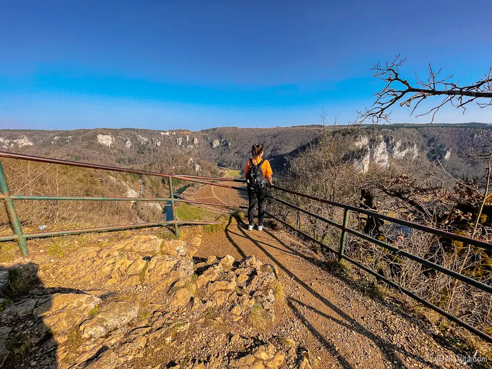
Images of my hiking adventure on this 10 km Beuron hiking route in the Upper Danube Nature Park

//embedr.flickr.com/assets/client-code.js

//embedr.flickr.com/assets/client-code.js

//embedr.flickr.com/assets/client-code.js

//embedr.flickr.com/assets/client-code.js

//embedr.flickr.com/assets/client-code.js

//embedr.flickr.com/assets/client-code.js

//embedr.flickr.com/assets/client-code.js

//embedr.flickr.com/assets/client-code.js

//embedr.flickr.com/assets/client-code.js

//embedr.flickr.com/assets/client-code.js

//embedr.flickr.com/assets/client-code.js







Leave a Reply