
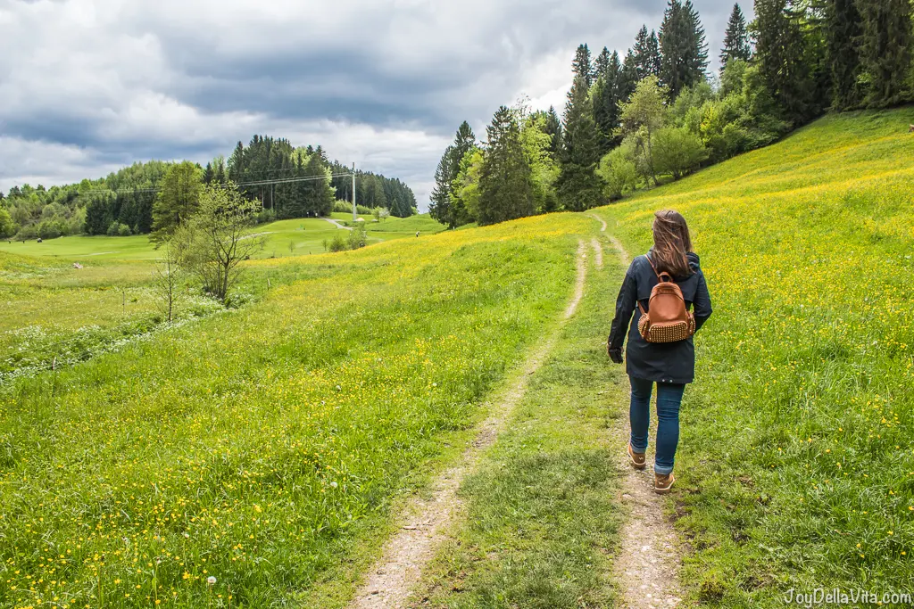
Hiking is a great way to enjoy nature in combination with physical activity. In a health-oriented town like Oberstaufen in the Bavarian Allgäu, it’s even mandatory to keep yourself moving, when following the rules of the famous Schroth cure. In between many hills and with a view of the 1834 meter high Hochgrat, you have the best hiking routes and walking trails right in front your doorstep. Personally, I did a guided Herbal Trail Tour organised by my Hotel, which I can highly recommend, but below now some more Hiking Routes around Oberstaufen in the Bavarian Allgäu.
For each Route, I’ve added a Google Maps Route, for you to open it on your own device.
Hiking Route: Around the Staufen – 4,5 km
This Route for an easy hike and walk around the mountain Staufen starts at the Train Station in Oberstaufen. From there you cross the railway, near the local history museum, follow the Immenstädter Straße, and then the footpath once around it. After about 1,5 hours you should arrive back at the Train Station, in the city centre of Oberstaufen. At about half the journey there will be two Restaurants, Hubertusstube and Hündle Stuben.
[googlemaps https://www.google.com/maps/embed?pb=!1m42!1m12!1m3!1d10770.984682353284!2d10.027367839661432!3d47.55326874882528!2m3!1f0!2f0!3f0!3m2!1i1024!2i768!4f13.1!4m27!3e2!4m5!1s0x479b7a2ff4af065d%3A0xa2c7eafa59c67c32!2sOberstaufen+Bahnhof+(Busbahnhof)%2C+Oberstaufen!3m2!1d47.553619999999995!2d10.025036!4m5!1s0x479b7a2948db20c9%3A0x2c382c38998c462d!2sImmenst%C3%A4dter+Str.%2C+87534+Oberstaufen!3m2!1d47.5580068!2d10.0312407!4m3!3m2!1d47.5577821!2d10.0392289!4m3!3m2!1d47.5502381!2d10.0438298!4m5!1s0x479b7a2ff4af065d%3A0xa2c7eafa59c67c32!2sOberstaufen+Bahnhof+(Busbahnhof)%2C+87534+Oberstaufen!3m2!1d47.553619999999995!2d10.025036!5e0!3m2!1sen!2sde!4v1495734741919&w=600&h=450]
Hiking Route: Oberstaufen – Paradies – Kapf – 7 km
This Route is a bit more advanced than the Route above. You start at the Train Station in Oberstaufen and exit the city by passing the Schlossbergklinik and after about 2 km you arrive at Cafe Paradies from where you can enjoy beautiful views of Germany, Austria and Switzerland. Later, a hike will lead you up the 998 metre high mountain ‘Kapf’, again you can enjoy nice views. The Route now takes you back to the centre of Oberstaufen, by passing the Kurgarten garden next to the Lindner Hotel.
[googlemaps https://www.google.com/maps/embed?pb=!1m50!1m12!1m3!1d7360.7755303665235!2d10.01081444948866!3d47.5518350581118!2m3!1f0!2f0!3f0!3m2!1i1024!2i768!4f13.1!4m35!3e2!4m5!1s0x479b7a2ff4af065d%3A0xa2c7eafa59c67c32!2sOberstaufen+Bahnhof+(Busbahnhof)%2C+Oberstaufen!3m2!1d47.553619999999995!2d10.025036!4m5!1s0x479b7a251130ccf3%3A0x5fcafea06c689af1!2sBRK+Schlossbergklinik+Oberstaufen%2C+Schlo%C3%9Fstra%C3%9Fe+27+-+29%2C+87534+Oberstaufen!3m2!1d47.551429999999996!2d10.017455!4m5!1s0x0%3A0x17e7df59f4abbf55!2sCafe+Alpage+Baviere+Cafe+Berghof+am+Paradies!3m2!1d47.54772!2d9.99816!4m3!3m2!1d47.5551483!2d9.9982203!4m5!1s0x479b7a2180a8a0b3%3A0xe7cf4f6f34d592d5!2sKurhaus%2C+Argenstra%C3%9Fe%2C+Oberstaufen!3m2!1d47.5581387!2d10.0164977!4m5!1s0x479b7a2ff4af065d%3A0xa2c7eafa59c67c32!2sOberstaufen+Bahnhof+(Busbahnhof)%2C+87534+Oberstaufen!3m2!1d47.553619999999995!2d10.025036!5e1!3m2!1sen!2sde!4v1495735699917&w=600&h=450]
For more hiking Routes around Oberstaufen, visit the website www.oberstaufen.de/en/experience/in-summer/hiking/. There are also 3 Premium Tour Routes available, but neither of them start in the centre of Oberstaufen.
More Oberstaufen and Allgäu: Oberstaufen, Allgäu and Hiking posts, plus the Fitness and Germany categories. Recover after your hike with my tips for a first time at a spa, read what you did not know about Dirndl and see more in my Travel Year 2017.
FAQ: Hiking routes around Oberstaufen
What are the best hiking routes around Oberstaufen?
This post describes an easy 4.5 km route around the Staufen mountain and a more advanced 7 km route via Café Paradies and the Kapf, each with a Google Maps route.
How long does the route around the Staufen take?
About 1.5 hours. It starts and ends at the train station in Oberstaufen, with two restaurants, Hubertusstube and Hündle Stuben, about half way.
How hard is the Oberstaufen, Paradies and Kapf route?
It is a bit more advanced at 7 km, with views of Germany, Austria and Switzerland at Café Paradies and from the 998 metre high Kapf.
Why is hiking popular in Oberstaufen?
Oberstaufen is a health-oriented town where movement is part of the famous Schroth cure, with hills and a view of the 1834 metre high Hochgrat.
Are there guided tours?
I did a guided Herbal Trail Tour organised by my hotel, which I can highly recommend.
Are there more routes?
Yes, the Oberstaufen tourism website lists more routes, including 3 Premium Tour Routes that do not start in the town centre.







Leave a Reply